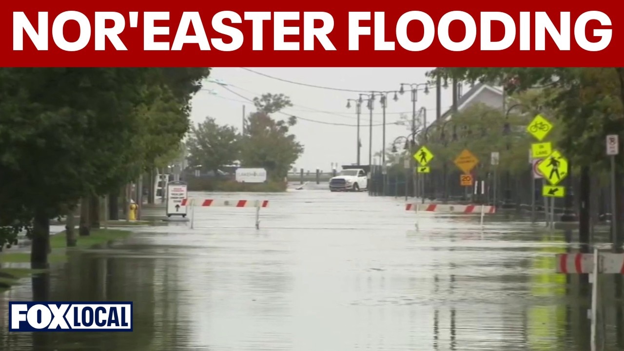
Slow-Moving Fall Storm Lingers Across the Seaboard
A persistent, slow-moving autumn nor'easter continued to hammer the U.S. Northeast on September 28, 2026, bringing heavy rain, gale-force winds, and significant coastal flooding to major metropolitan areas and vulnerable shorelines. According to forecasts and regional reporting, the sprawling system left tens of thousands of utility customers without power and disrupted travel across Boston, New York City, Long Island, and coastal New England.
Meteorologists noted that while peak wind gusts began to ease slightly by Sunday evening, bands of moderate to heavy rainfall continued to sweep across the region. The National Weather Service maintained flood watches for parts of New England through late Monday, warning that localized inundation in low-lying and poor-drainage areas remained a primary hazard as the storm slowly tracks eastward.
Rainfall Totals and Infrastructure Impacts
According to live updates from ABC7, rainfall totals mounted rapidly over the weekend. Central Park recorded 1.46 inches of rain during Sunday alone, pushing its total from the storm system to 2.44 inches. Eastern areas, particularly Long Island, saw even higher accumulations, approaching nearly 4 inches of rain as persistent bands pushed onshore.
The severe weather caused widespread disruption to regional infrastructure. Utility trackers and news reports indicated that between tens of thousands and approximately 130,000 customers lost electricity across the affected states due to falling tree limbs and powerful gusts. Local authorities also reported at least one fatality linked to the dangerous weather conditions as emergency crews responded to flooded roadways and downed power lines.
Coastal Flooding and Forecast Outlook
Although coastal flood warnings began to be lifted in parts of New Jersey, New York, and Massachusetts as the system showed early signs of weakening, high surf and moderate coastal flooding remained a threat from the mid-Atlantic up through New England. Weather.com identified Boston as remaining within a high-concern zone for persistent coastal inundation during high tide cycles.
Forecasters anticipate that the slow-moving system will continue to generate scattered showers and lingering atmospheric instability before fully exiting the region later in the week. Municipal officials across the affected states have urged residents to exercise caution on slippery roadways and to monitor local weather alerts as cleanup and restoration efforts get underway.
Comments (0)
No comments yet. Be the first to share your thoughts!