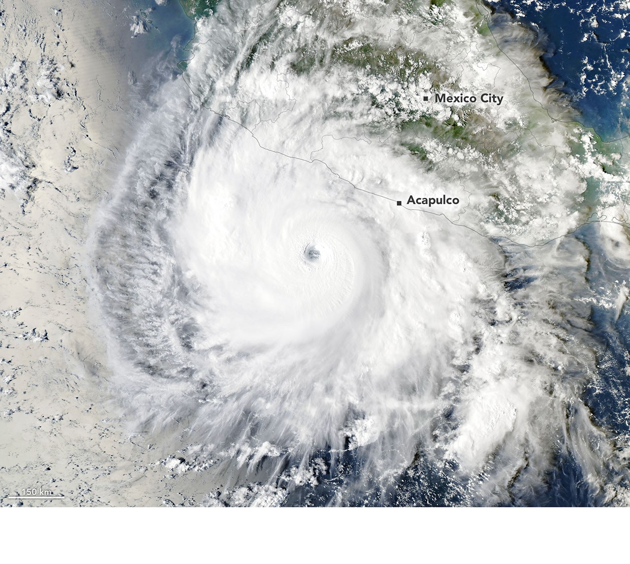
Overview of Hurricane Vance
Hurricane Vance has strengthened rapidly over the open waters of the eastern Pacific Ocean, achieving Category 1 status early Friday, according to the National Hurricane Center. Forecasters warn that the storm is poised for continued rapid intensification, threatening to transform into a major hurricane by Friday night or early Saturday.
As of 3:00 a.m. CST (0900 UTC) on Friday, October 23, 2026, the center of Hurricane Vance was located near latitude 10.9 North and longitude 102.1 West. This positioned the storm approximately 440 miles (710 kilometers) south-southwest of Acapulco, Mexico, and about 580 miles (930 kilometers) southeast of Manzanillo. The system was packing maximum sustained winds of near 85 mph (140 km/h) with higher gusts, and was tracking toward the north-northwest at a modest speed of 6 mph (9 km/h). Its minimum central pressure was measured at 982 mb (29.00 inches).
Intensification Forecast and Environmental Conditions
Satellite data evaluated by meteorologists revealed a significantly better-organized structure, displaying deep convection wrapped around a tightening inner core. Based on these observations, forecasters expect Vance to scale up swiftly over a 24-hour window. Current projections indicate the system could reach major hurricane strength—classified as Category 3 or higher—with winds approaching 115 mph by early Saturday.
Environmental factors supporting this acceleration include warm sea-surface temperatures, minimal vertical wind shear, high oceanic heat content, and abundant mid-level moisture. Computer models suggest the general north-northwestward motion will persist through the weekend. This trajectory is influenced by a weakening ridge over Mexico interacting with an advancing upper-level trough over the southwestern United States. Following its anticipated peak intensity over the weekend, the storm is expected to encounter cooler waters and increased wind shear, initiating a gradual weakening trend.
Potential Coastal Hazards
No coastal watches or warnings had been issued by the National Hurricane Center as of Friday morning. Nevertheless, authorities have cautioned that peripheral impacts are imminent. Swells generated by Vance are projected to reach parts of southern and southwestern Mexico over the weekend, creating life-threatening surf and hazardous rip-current conditions that are anticipated to persist well into next week. Coastal residents and maritime operators in the region have been advised to monitor subsequent advisories from local meteorological agencies.
Comments (0)
No comments yet. Be the first to share your thoughts!